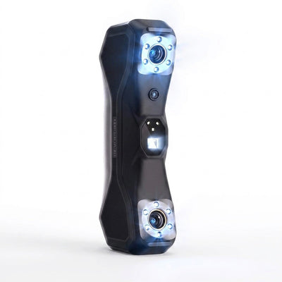
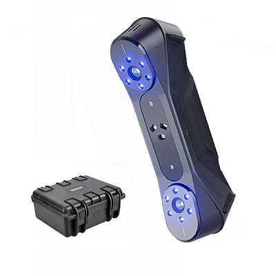
Handheld 3D Lidar Scanner Built for Precision Mapping, SLAM Technology, GPS Capable, Ultra-High Resolution
Engineered for professional mapping and design applications
Fast delivery
30-Day Returns
Survey quality
Global ready
-
SLAM technology seamlessly maps complex indoor and outdoor spaces
-
GPS capable positioning delivers survey-grade accuracy worldwide
-
Ultra-high resolution captures every detail for precise 3D models
-
All-in-one design eliminates need for multiple scanning devices







Advanced SLAM (Simultaneous Localization and Mapping) technology for real-time environment mapping. GPS-enabled positioning system for outdoor surveying applications. Ultra-high resolution imaging capability for detailed panoramic capture. Handheld ergonomic design for extended field use.
- Seamless indoor and outdoor data collection
- Real-time 3D point cloud generation
- Ultra-clear panoramic image capture
- Professional-grade mapping accuracy
Power on the device and calibrate GPS positioning. Select scanning mode based on environment (indoor/outdoor). Begin scanning by moving the device steadily through the target area. Data is processed in real-time with results viewable on connected display.
Free Shipping on Most Orders Within the Continental U.S. (Excludes AK/HI). Total delivery 6 to 11 business days (handling 1 to 3 business days, transit 5 to 8 business days).
30 days return window; report any damage within 48 hours. For returns, the customer pays return shipping on change-of-mind returns; we cover it for items that arrive defective, damaged, or incorrect. Restocking fee: 25% on approved non-defective returns (waived for defective, damaged, or incorrect items and exchanges). Refunds are issued within 14 days after we receive and inspect the return.

Separate GPS, scanner, imaging equipment

SLAM, GPS, imaging unified

Real-time 3D mapping anywhere

- Real-time environment mapping and positioning
- Complex indoor spaces mapped accurately

- Global coordinate accuracy for outdoor work
- Georeferenced data for GIS integration
Why Surveyors Choose Eagle

Point and Scan Simplicity
Instant 3D mapping anywhere

Survey-Grade GPS Lock
Global positioning precision

Ultra-Clear Image Capture
Professional panoramic quality
Engineering That Delivers
SLAM Tech Processing
Real-time mapping, zero calibration
GPS Global Ready
Worldwide positioning capability

Ultra-High Resolution
Professional panoramic capture
Handheld Ergonomic
Extended field use comfort

Handheld 3D scanner with SLAM technology and GPS integration

High-speed charging cable for device power management

Step-by-step setup and operation instructions

Access to Eagle scanning software and data processing tools
500+ Professionals Mapping Better
4.9/5
Average Rating
500+
Happy Customers
96%
Would Recommend
30-Day
Return Policy
| Feature | Eagle★ | Standard | Budget |
|---|---|---|---|
| SLAM Tech | |||
| GPS Ready | |||
| Handheld | |||
| Resolution | |||
| Real-Time |
The Eagle scanner provides professional-grade accuracy suitable for surveying and design applications. Range varies by environment, with optimal performance in spaces up to 100 meters.
Battery life depends on usage intensity and environmental conditions. Typical field use provides 4-6 hours of continuous scanning operation.
Yes, the Eagle outputs standard 3D file formats compatible with most CAD, GIS, and mapping software packages including AutoCAD, SketchUp, and ArcGIS.
The Eagle is designed for outdoor surveying applications and can handle normal field conditions. Avoid exposure to heavy rain or extreme temperatures.
No special certification is required. The Eagle is designed for intuitive operation, though we recommend reviewing the included documentation and software interface.


- SLAM technology seamlessly maps complex indoor and outdoor spaces
- GPS capable positioning delivers survey-grade accuracy worldwide
- Ultra-high resolution captures every detail for precise 3D models
- All-in-one design eliminates need for multiple scanning devices
Customer Reviews
Outstanding build quality and the scanning results are phenomenal. Perfect for our archaeological site documentation needs.
The fact that this level of technology fits in a handheld device still amazes me. Point cloud quality rivals our larger systems. Setup is intuitive and the real-time feedback helps ensure good scan coverage.
Originally hesitant about the investment but this scanner has paid for itself already. The combination of portability and professional-grade results is unmatched. GPS integration works seamlessly and the scanning speed is incredible. Highly recommend for any serious mapping work.
Been using this for three months now and it's proven reliable in various conditions. The precision mapping capabilities are impressive and data processing is straightforward. Battery life could be longer but overall very satisfied with performance.
Game changer for our construction documentation. Fast, accurate, and the data quality is outstanding.
Complete Your Setup